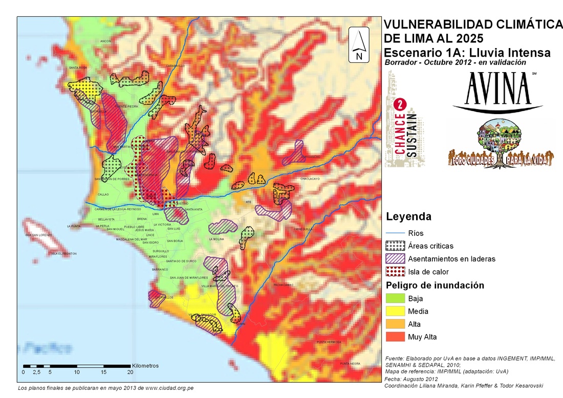
Risk maps of Lima
Both maps display areas considered as risky in red. Interestingly, only the left map acknowledges risks for the coastal areas of Lima and Callao, taking into account potential future earthquakes, tsunamis and the geological structure of the cliffs along the Costa Verde. Identifying areas as high risk deters interest and opportunity for development. Since Lima's coast is considered a highly profitable and attractive development site for the city, understanding the coastal zone as an area of low risk, thereby, 'eliminating' the risk, allows for the continued development along Costa Verde.
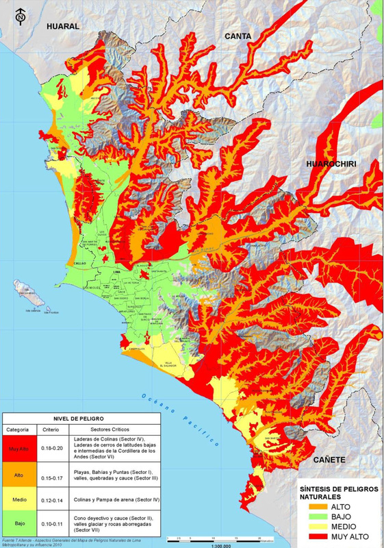
The right map is taken from a presentation given by the Environmental Department of the Regional Government of Lima in May 2013 which can be found under Reports and Plans.
The right map is taken from a presentation given by the Environmental Department of the Regional Government of Lima in May 2013 which can be found under Reports and Plans.
|
|
Picture the Coast: Insides to the PTAR Taboada and the coast of La Perla and San Miguel
|
|
|
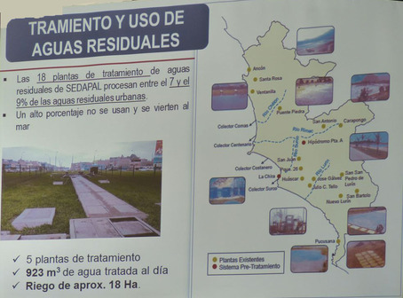
Waste-water treatment and use in Metropolitan Lima
Source: Environmental Department of the Regional Government of Lima
